Parcel Data for Satellite Earth Station and Teleport Siting
The global satellite ground station market will reach $230.9 billion by 2035. Learn how parcel-level data accelerates earth station siting, speeds FCC licensing, and reduces site selection time by 6+ months.
The Satellite Earth Station Boom and the Parcel Puzzle
The global satellite ground station market is projected to reach $230.9 billion by 2035 (Allied Market Research, 2025), fueled by the explosive growth of low-Earth orbit (LEO) constellations and the demand for high-speed broadband. To support thousands of new satellites, operators need a distributed network of earth stations—often called teleports—for command and control, data downlink, and payload hosting. Yet, site selection remains a major bottleneck. Identifying a parcel that meets technical, regulatory, and commercial requirements can delay projects by 6 to 12 months. Parcel-level data is the missing piece that turns open-ended searching into a precise, efficient process.
Key Parcel Attributes for Earth Station Siting
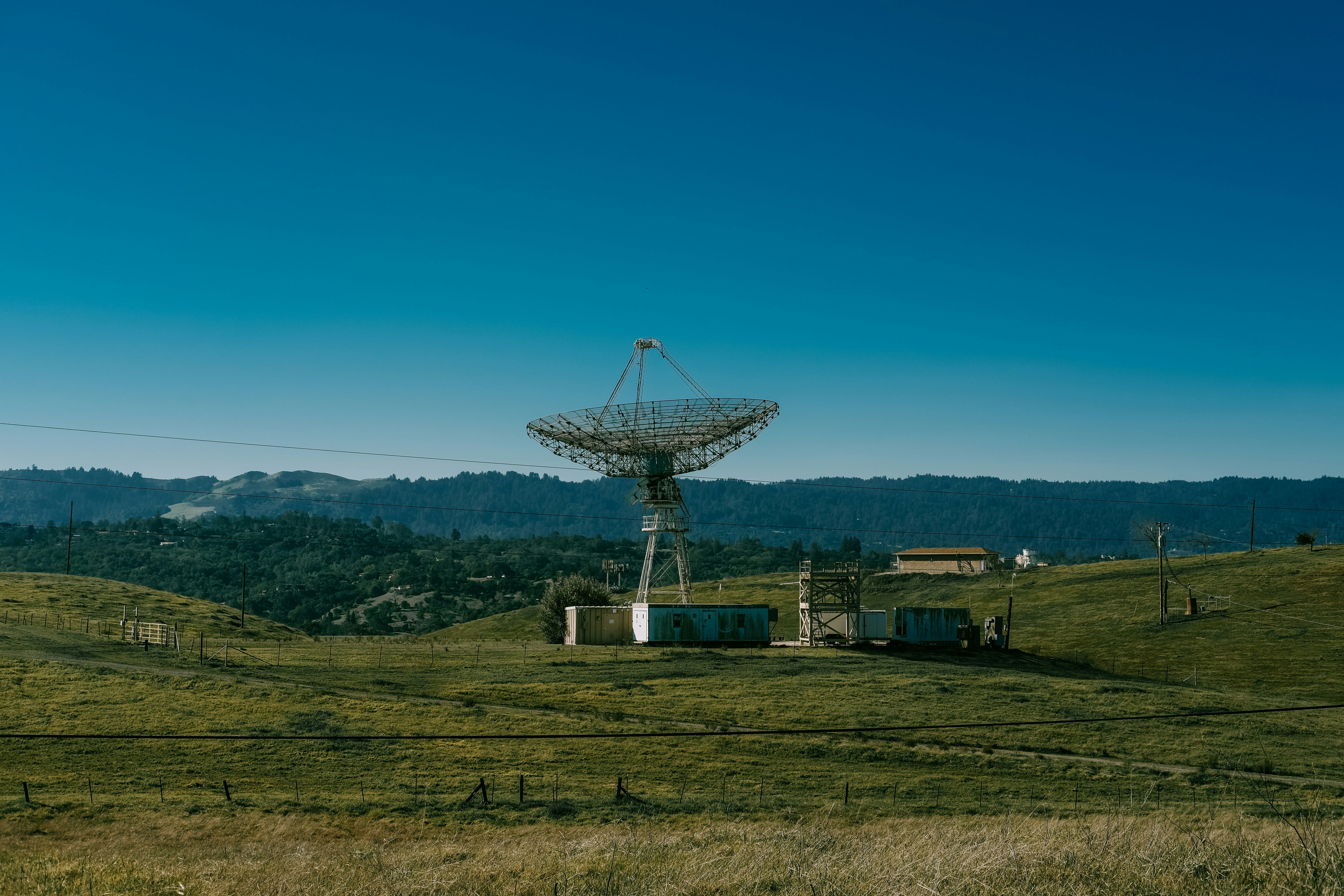
Not every plot of land is suitable for a satellite earth station. RF performance, infrastructure access, and legal clarity depend on detailed parcel characteristics:
- Space and geometry: A small 2.4-meter antenna may fit on a 0.5-acre parcel, but a full teleport with multiple large antennas (10–30 meters) requires 2 to 10+ acres, preferably with a regular shape to accommodate growth and maintenance access.
- Topography and line-of-sight: Earth stations require clear sky views toward satellite orbits—a parcel's terrain—hills, tall trees, or neighboring buildings—can create obstructions. Parcel boundaries define where you can clear vegetation and build infrastructure.
- Radio quiet and zoning: Nearby emitters (radars, industrial RF) cause interference. Zoning must allow communication towers and high-voltage power.
- Utilities and connectivity: Teleports consume significant power (5 kW to 500 kW+) and require high-bandwidth fiber. Proximity to substations and dark fiber routes is critical.
- Ownership and title: Fee-simple ownership simplifies acquisition. Leases and easements complicate projects.
- Environmental constraints: Wetlands, floodplains, and protected habitats may limit development.
Integrating Parcel Data with FCC Licensing
In the United States, earth station operators must obtain FCC licenses under Part 5 (experimental) or Part 25 (commercial).
Workflow: From Constellation Planning to Parcel Acquisition
The most efficient site selection process is parcel-driven from the start.
Case Study: Teleport Operator Accelerated Licensing by 6 Months
A regional teleport operator supported a LEO broadband constellation's ground segment across three U.S. locations. By leveraging comprehensive parcel data, the team screened over 50 candidate parcels in under 4 weeks, saving 6–9 months per site.
Future Trends: Mobile Teleports and AI-Powered Siting
Mobile teleports and AI-driven suitability scoring are reshaping ground station site selection.
Start Planning Your Earth Station Network
Explore how GetParcelData can accelerate your next ground station project →